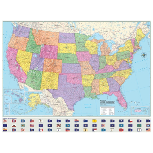
United States Map - Laminated - 45-1/4" x 37-1/2"
Product Code: 3002
Our Price: $16.99
Description
The U.S. Advanced Political Laminated Rolled Map measures 48" x 36". Includes inset maps of Alaska and Hawaii. The map features a wealth of information including country and state boundaries as well as capitals, major waterways, and major cities. Created with legibility in mind, each state is depicted in a separate color. State flags are also displayed. The Advanced Rolled Map Series highlights the United States with detailed cartography. Appropriate for grades 6-12.
Email a question about this item